
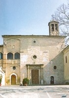
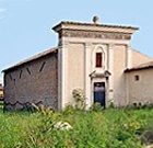
This walk takes you outside the city itself to an area that has produced extensive archeological evidence, particularly from Roman times. At its heart is the archeological area around the important suburban church of Santa Maria in Campis, where some scholars place Roman Fulginia:
-
✴The sections of the walk described in this page are:
-
•the start of the walk, from Porta Ancona along Via Piave to the city limit; and
-
•the end of the walk, from the underpass below the railway line of Via Santa Maria in Campis to Porta Romana.
-
✴The middle section, around the putative Roman city near Santa Maria in campis, is described in Roman Walk I.
Porta Ancona, Along Via Piave
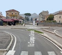
Leave Foligno from the site of Porta Ancona, at the end of Via Garibaldi. A city gate here was demolished in 1930. Cross Viale Cesare Battisti, to reach the railway line: the pedestrian underpass to Viale Ancona is signed to the left. On leaving the underpass, turn immediately right along Via Piave.
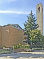
The modern church of San Giuseppe Artigiano is on the right, between Via Clitunno and Via Trasimeno.
Continue along Via Piave to the city limit.
This is the point at which in Roman Walk II begins
Detour to San Bartolomeo di Marano (40 minutes return)

Extension (50 minutes return) to see the Maestà Bella
Return to Via Piave and the city limit, where the detour ends.
If you are now doing the walk around the archeological area, go to Roman Walk II
To Santa Maria in Campis
If you are not doing the Roman walk, retrace your steps a little way and turn left along Via Rubicone.
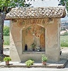
Detour to San Feliciano di Mormonzone (25 minutes return)
Turn left on leaving Santa Maria in Campis, along the road that runs along the wall of the civic cemetery. The brick walls enclose the original cemetery, while the area beyond belongs to an extension made in 1970.
This is sometimes taken to be the site ‘ad montem rotundum’ (at the round mountain) where St Felician died, which (according to his legend) was three Roman miles from ‘his city’. As set out in more detail in the page on the complex, this is fine if one assumes that St Felician’s city was Forum Flaminii (some 6 km to the north). Unfortunately, as Guerrini and Latini pointed out (at p. 53), although St Felician had been the bishop of Forum Flaminii, the legend generally reserves the phrase civitate sua for Fulginia (as in ‘civitatem suam Fulgineas’), which was much closer (whether it was near Santa Maria in Campis or at modern Foligno). In addition, as a glance around you will confirm, there is not a mountain in sight.
Retrace your steps to the church of Santa Maria in Campis, where the detour ends.
Santa Maria in Campis to Porta Romana
Turn right on leaving the church of Santa Maria in Campis and then left, to follow Via Santa Maria in Campis. This road turns sharply left at the T-junction, with the railway line on your right.
Take the underpass on the left to cross the railway line and continue along Via Santa Maria in Campis (with the massive military barracks on your right) to Viale Roma. Cross this road and turn right along it.
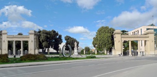
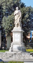
The monumental entrance to the old sports field is ahead on your left. The marble statue (1872) here of the important local artist Niccolò di Liberatore is by Ottaviani Ottaviano; medallion portraits of Raphael and Perugino decorate its base. Cross Viale Cesare Battista ahead.
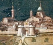
Porta Romana Detail of a panel (17th century) by
Ascensidonio Spacca, Pinacoteca Civica
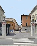
Porta Romana (in front of you) was the site of a gate (also known as Porta Contrastanga) in the 14th century walls. It was reinforced by huge towers in 1452, which can be seen clearly in the detail of the panel above. The gate was demolished in 1870. Remains of gate were excavated in 1989, when the canalised Menotre river, which ran along this section of the walls, was diverted underground to permit the building of Viale Cesare Battista.
Walk through the opening along Corso Cavour to return to the centre of Foligno, where the walk ends.
Return to the home page on Walks I-III in Foligno or Roman Walk II