
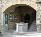
Leave Piazza della Repubblica along Via Filippeschi and fork left along Via della Cava. This ancient street, which is so-called because it has been cut out of the tufa, leads directly to what was historically the main entrance to the city. Indeed, it was probably the only entrance for many centuries.
Continue down the street, passing two interesting, privately owned museums:
-
✴the Museo delle Maioliche Medievali e Rinascimentali (ceramics museum) at number 8, which I have yet to visit; and
It is possible to detour at this point to visit the necropolis of the Crocifisso del Tufo, although you can alternatively visit the necropolis as part of Walk II.
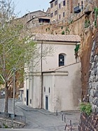
If you decide to do it now, walk across the facade of the Madonna del Velo to join a trail around Orvieto known as the Anello della Rupe (ring around the cliff). Continue to the point where the Cappella del Crocifisso del Tufo was cut into the rock in the 16th century.
There is an interesting view of the necropolis of the Crocifisso del Tufo from the viewing point beyond on the left. You can continue to the necropolis from this point, and then return to Santa Maria del Velo.
Continue to the end, turn right along the main road, left at the roundabout, left again along Strada dell’ Arcone and then next right along Via della Gabeletta to Tamburino.
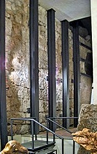
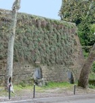
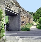
The road now crosses the Rio Chiaro: below on the left you can see relics of the ancient road from Orvieto to Bolsena:
-
✴part of the Etruscan road, illustrated here protected, as it now is and exposed during its excavation; and
-
✴the old bridge across the river.
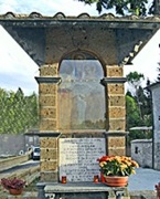
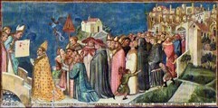
The altar beyond on the left (just before the road bends to the right) records the meeting here between Pope Urban IV and the bishop of Orvieto in 1264 as the latter brought the Sacro Corporale from Bolsena to Orvieto. A fresco (ca. 1364) in the Cappella del Corporale in the Duomo depicts this scene.
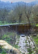
Continue along Via del Tamburino to the houses on the left and take the track on the right here that runs beside a field. This takes you to the main road, where you turn left. The restaurant "Girarrosto del Buongustaio" on the left has a lovely terrace with a fine view of Orvieto.
.
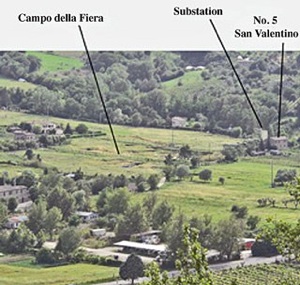
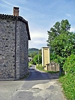
No 5 (on left here) and substation
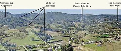
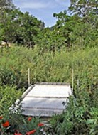
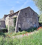
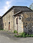
Turn right at the end and left just before the electricity substation, in front of the house at number 5, San Valentino. The lane leads to the excavations of an important cult site at Campo della Fiera. (The area is so-called because it was the site of commercial fairs in medieval times). Some scholars believe that this was the site of Fanum Voltumnae, the most important cult site in Etruria. It was also the site of San Pietro in Vetere, as described on the information board in the second field along the lane.
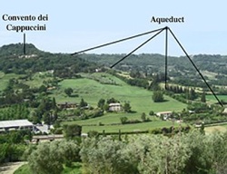
If you want to avoid a strenuous hike to the Convento dei Cappuccini (below), you have two other options:
✴Continue along the road and then turn right following signs to Hotel La Badia, which occupies the ex-Abbazia di SS Severo e Martirio (below).
✴Cross the road and follow the footpath along the remains of the aqueduct as it leads up through fields and back to the city. The path soon becomes a tarmac lane. Turn right at the main road and follow it round the bend. Continue along the footpath at the edge of the car park and then cross the upper level to the pay station. You have a choice of the lift or the escalator from here to Piazza Ranieri, where you can end the walk.
Return to the main road and turn right along it to the Strada Fontana del Lione on the left (opposite the petrol station).
If you do not want to take the steep road up to Orvieto, continue for about 1 km long the main road and then take the paved path to the left. This leads to a stretch of the old road that is now closed to traffic. It continues as a quiet tree-lined road into Orvieto Scalo (about another 1 km). Turn left at the T-junction to the funicular railway up to Orvieto, where you can end your walk.
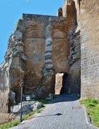
Turn left up the Strada Fontana del Lione towards the Rocca.
A final detour is possible from the Strada Fontana del Lione to the site of the Cannicella temple and necropolis (which is also possible as a detour in Walk I). If you are doing it now, take the first turning on the left and follow signs to B&B Cannicella. The signs lead you:
✴along two sides of the remains of the temple; and then
✴along a lane on the right, along the upper side of the temple, to one of the few exposed tombs from the necropolis.
(The B&B is just beyond, at the end of the lane. There is a large dog in residence, so be careful not to walk uninvited through its gates.)
Walk up to join the path around Orvieto known as the Anello della Rupe (ring around the cliff):
✴If the access is open, leave the path by walking up to Palazzo Crispo Marsciano (the start of the detour in Walk I) and continue into Piazza del Duomo,where you can end your walk. However, this point of access was closed for maintenance at April 2012.
✴Alternatively, follow the path:
•clockwise to the lift up to Piazza Ranieri, where you can end your walk; or
•anti-clockwise to Porta Postierla, and continue as below.
Continue along Via Postierla, which becomes Via Soliana. This takes you to Piazza del Duomo, where the walk ends. (You will find this route described in detail in Walk III).
Return to Walks Around Orvieto.