
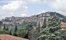
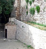
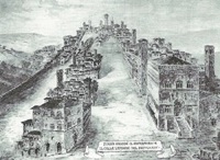
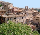
View of Colle del Sole on the right and a
Colle Landone (much-reduced since Etruscan times) on the left
The forum of the Etruscan city (now Piazza IV Novembre)
was in the hollow between these two hills
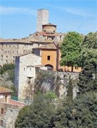
This walk follows the line of the walls of Etruscan Perugia, which were probably begun in the 4th century BC. They seem to have been substantially rebuilt when the city passed under Roman control after the Battle of Sentinum (295 BC). The circuit stretched for some 3 km around two hills: Colle del Sole to the north and Colle Landone to the south. Each of these hills was later to be the site of a papal fortress that made use of the Etruscan foundations while destroying large sections of the walls:
-
✴Fortezza di Porta Sole (1373) on Colle del Sole; and
-
✴Rocca Paolina (1540) on Colle Landone (which was much-reduced in height during the demolition that preceded its construction).
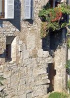
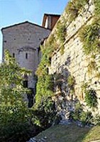
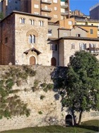
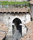
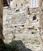
Just over 1 km of the original circuit of the Etruscan walls is still easily visible, along with the remains of five Etruscan city gates. Before beginning the tour of these remains, visit Pozzo Etrusco, the entrance to which is at number 18 Piazza Danti.
Leave the piazza along Via Ulisse Rocchi, which follows the line of part of the cardus maximus of the ancient city. This thoroughfare retained its importance until 1378, when what is now Via Bartolo was built to the right of it, on the line of the moat that had run along the western side of Fortezza di Porta Sole. It was re-named as Via Vecchia at this point, and was renamed again in the early 20th century in honour of Ulisse Rocchi (died 1903), the first mayor of Perugia after the city joined the Kingdom of Italy.
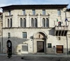
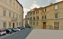
The street then widens, with Piazza Ansidei on the left.
-
✴The piazza was so-named in 1871 in honour of the family whose palace, Palazzo Ansidei di Montemarte, dominates it (at number 4).
-
✴It was originally called Piazza San Donato, a reference to the ex-church of San Donato at number 29-31 Via Ulisse Rocchi (just ahead, on the right), a building now occupied by a pizzeria.
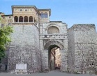
From Arco Etrusco to Porta Trasimena
Continue into Piazza Cavallotti. The original name of the piazza was Piazza degli Aratri (of the ploughs), a reference to the market for agricultural equipment that was held here in the Middle Ages. It was renamed in honour of Felice Cavallotti, a Milanese who fought for Giuseppe Garibaldi in 1860-6 and who then served in the Parliament of the united Italy.
-
✴Palazzo Bonucci Baldeschi (which can be seen at the extreme right in the painting) survives at the junction with Via Baldeschi; and
-
✴some remains of the arches of the left wall of Santa Maria degli Aratri can be seen incorporated into the right wall of the house at 2-8 Piazza Morlacchi.
Palazzo Aureli Teatro Civico
later Palazzo Manzoni Ansidei from 1874, Teatro Morlacchi
Turn left into Piazza Morlacchi and take a short detour to look at it. This piazza took on its present form in 1874 (following the demolition of Santa Maria degli Aratri, as mentioned above), when what were then two piazze were merged:
-
✴Piazza Aureli, which was named for Palazzo Aureli (now Palazzo Manzoni Ansidei) on the right; and, beyond it,
-
✴Piazza del Teatro Civico, which was named for what is now Teatro Morlacchi.
The newly-created piazza and the theatre were, respectively, named and renamed in honour of the Perugian composer Francesco Morlacchi at that point.
The low building opposite Palazzo Manzoni Ansidei, which used to be the Garage Gelsomini, was adapted in the 1960s to house the Biblioteca Umanistica of the University of Perugia. During the work of adaptation, traces of the walls of an ancient building and of its a mosaic pavement (6th century AD) were discovered: the latter are exhibited in the Museo Archeologico. [More recent excavation has revealed part of a mosaic (6th century AD) that seems to have belonged to a church]
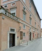
Palazzo Bianchi Palazzo Stocchi-Isidori
Two palaces stand on the left, opposite Teatro Morlacchi:
-
✴Palazzo Bianchi (next to the Biblioteca Umanistica), which was built at the point where the two originally separate piazze met, as part of the redevelopment of the area; and
-
✴Palazzo Stocchi-Isidori, beyond it.
-
✴in the garden of number 20; and
-
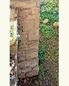
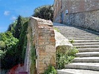
✴under the house at number 10, seen from the brick parapet between numbers 8 and 10 in this photograph.
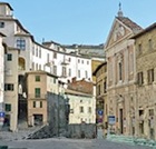
From Porta Trasimena to Arco della Mandorla
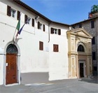
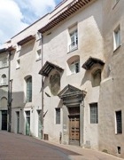
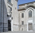
Walk down the steps and turn left along Via della Sposa. Turn left, just before Porta Santa Susanna (visited in Walk III), along Via Tornetta. Immediately on the right is the secularised church and convent of Santa Chiara. This complex was built on the probable site of the demolished church of Santa Mustiola.
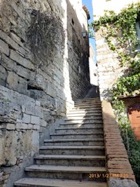
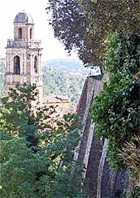
Via Tornetta runs between the lines of the Etruscan and medieval walls (on the left and right respectively). From the end o fit, you can see the line of theEtruscan walls to the left. However, access is restricted. Instead, cross the car park in front of you to the “scala mobile” (escalator) on the left. The car park stands in what was originally the gardens of Palazzo degli Oddi above. Travel up one flight of the escalator (which then continues to Via dei Priori) and take the path on the right through the park. Turn left at the end and walk up the stepped Via Canapina, where you can see a long stretch of walls on the left.
There is also a nice view from here of the facade of Santa Maria della Valle. Retrace your steps through the gate and walk along Via Cupa to see this church. Take a short detour along Via della Luna, to the left of it, to see its lovely apse.
From Arco della Mandorla to Porta Marzia
Turn left along Via Fatebenefratelli, which hugs the terrace that supports the Viale Indipendenza. Follow it as it turns right (becoming Via della Consolazione) and then immediately left (reverting to its original name) and continuing to follow the terrace. This street skirts the part of Rione di Porta Eburnea that is described in Walk VII.
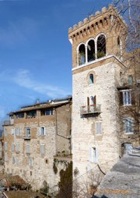
Turn left at the end of Via Fatebenefratelli into Viale Indipendenza and continue to Torre dei Donati (photographed above) on the left. You can look down from here along the line of the walls back to Porta della Mandorla (see above).
Walk through the opening at number 7, under the terrace beyond, which leads to the excavated area under the site of Rocca Paolina. Turn right along the subterranean Via Bagliona, which runs parallel to the line of Viale Indipendenza. (A fuller exploration of the remnants of the fortress is undertaken in Walk VII).
From Porta Marzia to Piazza Matteotti
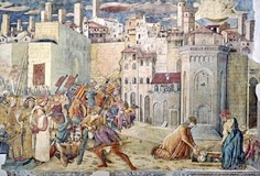
Continue to what was the lower the church of Sant’ Ercolano on the left:
-
✴The photograph at the centre here is of a fresco late 15th century by Benedetto Bonfigli in the Cappella dei Priori (now the Galleria Nazionale). It shows Totila’s troops camped on the site of the amphitheatre in ca. 548, at the end of their successful siege of Perugia. The body of St Herculanus, who has been executed on Totila’s orders, is being buried in front of an anachronistic representation of the church that was later dedicated to him. The fresco shows three interesting details of the situation before the construction of Rocca Paolina:
-
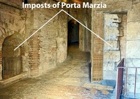
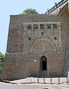
•Porta Marzia is still in place;
-
•the upper church still has its original form; and
-
•a road leads directly down from Porta Marzia to the lower church of Sant’ Ercolano.
-
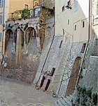
✴The photograph on the left shows the ramp in the retaining wall to the left of Sant' Ercolano that probably marks the original line of this road.
Continue up Via di Sant’ Ercolano. The trigram “d,m,e” (domus Misercordie) on the buildings at numbers 14, 4 and 2 on the right denote that these were part of the Ospedale di Santa Maria della Misericordia (see below). Turn right into Via Oberdan, which follows the line of the Etruscan walls. This road, which is now named in honour of the jurist Guglielmo Oberdan (died 1882), was previously known as Via dell’ Ospedale. The level of the street was drastically lowered in 1581 in an urban remodelling commissioned by the papal legate, Giovanni Francesco Biandrate di San Giorgio. The buildings on the right were built above the Etruscan walls.
Take a short detour by turning immediately left up the steps of Via Santa Lucia and right along Via degli Alunni. This street is named for a building (probably at number 9-13) where abandoned babies could be left. Retrace your steps and turn left to continue along Via Oberdan.
[A stretch of the walls can be seen under the floor and again in "La Libreria Oberdan", the excellent bookshop that now occupies two floors of the ex-hospital (at number 52). Note, this shop closed in 2010, but there are said to beplans to re-open it. It currently houses a branch of the clothes chain “Subdued”.]
Continue along Via Oberdan:
-
✴Palazzo Armellini is at number 40-50.
-
✴Palazzo Crispolti is at number 39-43 opposite.
-
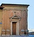
✴The ex-church of San Giuseppe is at number 38.

Continue into Piazza Matteotti.
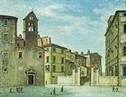
Piazza Matteotti
This piazza (like many squares and streets in Italy) is named for Giacomo Matteotti, a socialist politician who was assassinated by Fascists in 1924. It is still sometimes referred to by its ancient name, Piazza Sopramuro (piazza above the walls). This print (1947) by Giovanni Ellero reconstructs the situation in the 13th century: Piazza Sopramuro on the left was linked by a series of side streets to the southern part of Piazza Grande (see Walk I). The parapet that originally ran along its left side (on your right as you enter the piazza) followed the line of the Etruscan walls in a concave curve to meet what is now Via Alessi (at the far end of the present piazza). There was a prison below the cliff where St Francis of Assisi was held as a prisoner of war in 1202.
The edge of the cliff was subject to erosion, so a sustaining wall was built at its base in ca. 1250. The space between the two walls filled up with rubbish and with the spoil from demolished buildings. In the late 13th century, Fra’ Bevignate buttressed this wall so that it supported a paved terrace, the so-called Campo di Battaglia, some way below the present level of the square. This space took its name from the Battaglia dei Sassi (Battle of the Stones), an annual stone-throwing contest between representatives of the rione (the five districts of Perugia). This tradition came to an end in 1425, when St Bernardino of Siena preached against it.
In the early 1420s, Braccio Fortebracci further buttressed the Campo di Battaglia with new walls and arches (which you saw in the detour above) so that it was now capable of supporting buildings. It seems to have been levelled and repaved in 1424-5 using material from the demolished Fortezza di Porta Sole. However, it was to be some decades before the open view from the terrace was blocked by buildings:
-
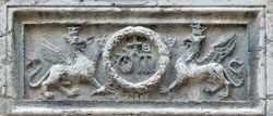
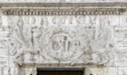
✴The arcade of shops on the right (number 24-38 Piazza Matteotti and number 2-6 Via Oberdan) was built in in 1472-6 by the Ospedale di Santa Maria della Misericordia as an extension to their premises in what is now Via Oberdan (above). The architrave of what is now number 32 (illustrated here) carries the coat of arms of the hospital and the date 1472.
-
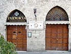
✴The Farmacia San Martino at number 26, which was founded in 1594, still belongs to the Sodalizio di San Martino.
-
✴The Palazzo dell’ Università Vecchia was built as two storeys above the arcade of shops in 1483-1512.
All of these buildings (together with the ex-Jesuit convent beyond them - see below) now house the Tribunale di Perugia (the Perugian law courts and associated offices).
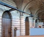
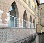
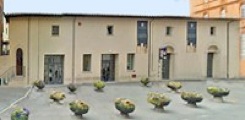
Loggia dei Lanari: Interior Loggia dei Lanari: Exterior
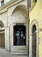
The Gothic archway at number 18 and the one behind it lead to the 14th century Loggia dei Lanari (the loggia of the wool-merchants), which now houses an office of the Informazioni ed Accoglienza Turistica (IAT - Tourist Office). Walk through the arch to see the outside wall of the loggia (illustrated above, to the right).
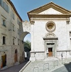
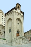
Chiesa del Gesù San Fiorenzo
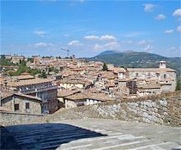
Continue around the open market to the terrace, the site of a lively bar that offers a splendid view over the southern part of town and the valley below. As you look out over the valley, the view to the left takes in:
-
✴the campanile of San Fiorenzo (visited in Walk VI); and
-
✴further round in an anti-clockwise direction (so you are looking away from the valley), the pensile apse of the Chiesa del Gesù (see below), high above a sustaining tower that contains three oratories, one on top of another.
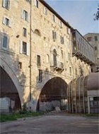
Steps to the sides of the terrace lead down to the covered market (1932), which was established on a terrace that Cardinal Francesco Armellini had commissioned in 1520 for a new college. (This project had been aborted after his death in 1527).
Retrace your steps to Piazza Matteotti:
-
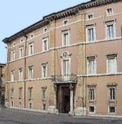
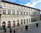
✴Palazzo delle Poste (1911-6), which was designed by Osvaldo Armanni, stands on the opposite side of the piazza. [Frescoes by Annibale Brugnoli ?]
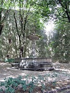
The neo-classical Fontana del Nettuno (1854) that now stands in the park next to Sant’ Ercolano (above) seems to have been moved there from Piazza Matteotti to make way for a monument (1887) to Giuseppe Garibaldi. This monument was moved to the roundabout in Largo Cacciatori delle Alpi (see Walk VII) in 1933.
From Piazza Matteotti to Arco dei Gigli
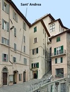
-
✴Via Sant’ Andrea takes its name from the church of Sant' Andrea, on the corner of this street.
-
✴Via Volte della Pace runs along the line of the Etruscan walls as they swung to the right.

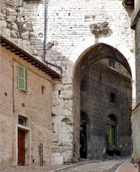
From Arco dei Gigli to Arco Etrusco
The next section of walls was destroyed in 1373 to make way for Fortezza di Porta Sole (below), and it is no longer possible to follow the line exactly.
Turn left and walk through Porta dei Gigli and along Via Bontempi (see Walk VII). The building immediately on the right at number 48, which now forms part of Palazzo Montesperelli (17th century), blocks what was a street that followed the line of the walls to the back of San Severo (see below).
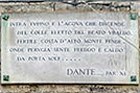
"Between Topino and the stream that pours down
from the hill chosen by the blessed Ubaldo [St Ubald of Gubbio],
a fertile slope slants from a soaring mountain [Mount Subasio].
It makes Perugia feel the cold and heat through Porta Sole"
The stepped street down along the right of the chapel is now a cul-de-sac: it originally formed a T-junction with the street that ran along the line of the walls from Porta dei Gigli (see above) and along the back of San Severo.
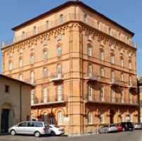
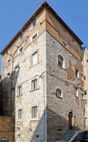
Retrace your steps, cross the facade of San Severo, and turn right along Via dell’ Aquila into Piazza Biordo Michelotti. This is the highest point in the city and was at the heart of Fortezza di Porta Sole (1372-5). It was originally known as Piazza Monte di Porta Sole, but was renamed in 1871 in honour of Biordo Michelotti, who was murdered in his house here (see Palazzo Verrachi below) in 1398.
-
✴The three palaces on the left stand on a terrace that was built for the fortress, the buttresses of which are visible from Piazza Piccinino (see below). They are:
-
•Palazzo Cesarei (16th century) at number 5, which housed a meteorological station in the 19th century;
-
•Palazzo Montesperelli (17th century) at number 6 - 13 (on the left in the photograph above), which incorporates a tower house to the right; and
-
•Palazzo Mori (17th century) at number 15 - 1.
-
✴The piazza contains two other interesting palaces:
-
•The palace on the right (behind you in the photograph), which has an imposing double staircase, was rebuilt after the bombing of the Second World War.
-
•The most important building in the piazza is Palazzo Veracchi, at number 1 (on the right in the photograph).
-
✴Palazzo Rossi Scotti on your right (as you look over the terrace);
-
✴Palazzo Conestabile della Staffa behind you (with its main entrance in Via delle Prome, at number 15), which now houses the Biblioteca Augusta; and
-
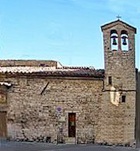
✴the ex-church of Sant’ Angelo della Pace on your left (illustrated here).
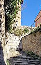
Leave Piazza Rossi Scotti along the right side of Sant’ Angelo della Pace and continue along Via delle Prome. a stepped street that runs down in three zig-zag stretches, the second of which runs along the line of the walls. There is a magnificent view of the Rione di Porta Sant’ Angelo from the top, with Sant' Agostino (visited in Walk V) prominent on the right.
Return to Piazza Danti, where the walk ends.