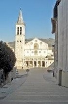
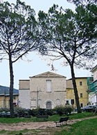
The walk begins outside the Duomo, which stands on an artificial terrace below Colle di Sant’ Elia, the highest point of the city. This hill was the site of a walled citadel from at least from the Bronze Age and was probably the site of the acropolis of the Roman city.
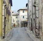
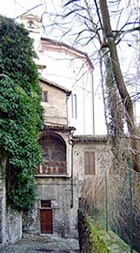
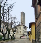
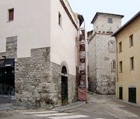
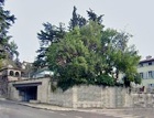
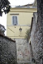
Walk down the steps ahead and to the right (with your back to the Duomo) and continue down Via delle Mura Ciclopiche. This street is so-named because it follows the line of a fortified road that ran along the outside the Roman walls. The present street, which was laid out in the 16th century, stops at the foot of the steps that lead from Piazza del Duomo, but it originally continued to the acropolis (later the site of the Rocca, above and to the right in this photograph).
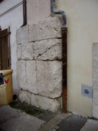
Remains of Roman wall can be seen near the bottom, in the right wall of the house at number 28 on your left (at the extreme right in this photograph). There are more extensive remains in the private garden opposite.
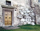
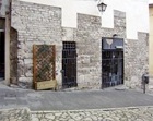
Turn left along Via della Ponzianino. The remains of Porta Ponzianino, which stands on the site of a Roman gate, can be seen in the wall of number 55 and in that of the house opposite. The first street beyond on the left, Via dell Assalto is so-called because it follows the route that the soldiers of the Emperor Frederick I took when broke through Porta Ponzianino and stormed the city in 1155.
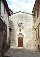
The facade of Sant' Omobono, the church of the Monastero delle Palazze, is in the piazza on the right. Continue past the adjoining nunnery to the facade of the Augustinian church of San Nicolò (now used for exhibitions) and its cloister beyond.
Walk back across the facade of San Nicolò and turn left along its right side into Piazza della Misericordia.
-
✴The building ahead (at right angles to the church) belonged to the Confraternita della Misericordia e della Buona Morte and has an interesting but damaged fresco on its wall (described on the page on Santa Maria della Misericordia - see below).
-
✴The entrance to the Monastero delle Palazze is on the left.
Continue ahead along Vicolo della Misericordia, which runs between San Nicolò (on the left) and the Monastero delle Palazze. There is an interesting fresco (16th century) in the loggia near the bottom on the left that depicts the Crucifixion with the Virgin and St John the Evangelist. Like the building above, this one also belonged to the Confraternita della Misericordia e della Buona Morte (see Santa Maria della Misericordia, below).
Continue down to Via Cecili. The imposing tribune of San Nicolò on your left breaks through the line of the Roman wall. The subterranean church of Santa Maria della Misericordia, which was built as a crypt underneath it, belonged to the Confraternita della Misericordia e della Buona Morte.
Take a short detour by turning right along Via Cecili:
-
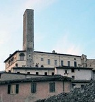
✴Tribune and campanile of San Omobono above the on the left stand on foundations supplied y the Roman wall.
-
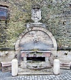
✴[Describe the fountain beyond on the right]
Return to the tribune of San Nicolò. Steps across the road lead down to Santa Maria della Piaggia, which is outside the area of the Roman city.
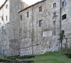
Continue along Via Cecili, past a fine stretch of the Roman walls that provide the foundations for the ex-convent of San Nicolò. [Carducci inscription]
Continue past the north facade of the palace into Piazza Torre dell’ Olio, with another stretch of the Roman walls on the left.
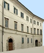
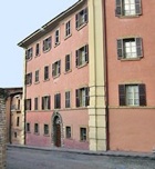
Take a short detour by turning right along Via Porta Fuga to Porta Fuga, which stands on the site of a Roman gate through which a spur of Via Flaminia entered the city. The south facade of Palazzo Vigili is on your right. [The south and west facades are pictured here]
-
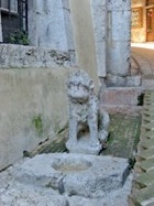
✴The fountain in front of the south facade of the palace incorporates a statue (12th century ?) of a lion that guards a fragment of the Roman pavement. (The more extensive Roman pavement on the other side of Via Porta Fuga is covered during nearby restoration work - January 2009).
-
✴The Torre dell’ Olio beyond, which is incorporated into the palace, stands on what seem to be Roman foundations, as do three others nearby (see below).
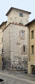
Retrace your steps into Piazza Torre dell’ Olio: the tower house on the right at the start of Via Porta Fuga is the second of those here that stand on what seem to be Roman foundations.
Take a short detour from Piazza Torre dell’ Olio along Via Salaria Vecchia ahead (across the zebra crossing), which runs along the line of the Roman cardo maximus and leads back to the heart of the city.
The first street on the right leads to the site of a small church dedicated to St Sabinus that was known as San Sabinuccio. The Oratorian Fathers stayed here in ca. 1625-40 before they built their new church of San Filippo (see below). San Sabinuccio was adapted for residential use in 1921.
Retrace your steps along Salaria Vecchia:
-
✴The portal at number 3 on your right came from San Sabinuccio.
-
✴The tower house at the corner on the left is the third of those here that stand on what seem to be Roman foundations.
Turn left along Via Pierleone Leoni to Piazza Moretti on the right:
-
✴The tower on the corner is the so-called Cassero dei Perugini: this is the fourth of those here that stand on what seem to be Roman foundations. The lower part of the tower might have formed part of the fortress that the Perugians built here during the Ghibelline rebellion of 1325. Cardinal Gil Albornoz ordered its destruction when he took Spoleto back into direct papal control in 1354.
-
✴The ex-church of San Salvatore Minore (1715) at the far end was built on the site of a much older one. Bishop Lorenzo Castrucci established an orphanage here in 1621.
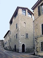
Take the next turn on the right, along Via delle Scuole. There is an interesting tower house on the corner.
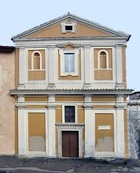
The street leads into Piazza XX Settembre, which is named for the date in 1870 on which papal Rome fell to the soldiers of the Kingdom of Italy. The Chiesa della Trinità is on the right. Traces of the Roman walls have been found under the adjacent ex-nunnery.
The imposing tribune of San Domenico (see below) is on the opposite side of the piazza. The closed entrance to the right of the it once led to the subterranean church of San Pietro Martire. The buildings beyond on the right once formed part of the convent of San Domenico, and include the ex-prison of the inquisition: they now house the Istituto Statale d’ Arte “Leoncillo Leonardi”.
The monument (1919) on the wall here commemorates the students from Spoleto who died in the First World War.
Turn left and then right into Piazza San Domenico and walk along the right side of the Dominican church of San Domenico to the entrance in its facade.
On leaving the church, fork diagonally to the left into Piazza Collicola: this piazza is dominated by Palazzo Collicola, which runs along its south side. The palace now houses the Galleria Civica d' Arte Moderna.
Take a short detour by continuing along Via Cattaneo and turn right into Vicolo della Cisterna. This tiny cul-de-sac is named for the Roman cistern that is now incorporated into the house on the left.
Retrace your steps to Piazza Collicola and turn left along the left side of Palazzo Collicola: the far corner of the palace incorporates blocks that seem to have come from the Roman wall.
The road leads into Piazza di Porta San Lorenzo.
Turn right a little way up Via Sant’ Agata (the street to the right above): the gate for which the piazza is named probably stood at the point where there is now a loggia on the left and a house (number 2) opposite. This seems to have been the site of a Roman gate that is recorded in the statutes of 1296: it was given this name because it led to the important church of San Lorenzo in Terzo la Pieve.
Return down Via Sant’ Agata and turn left along Via delle Monterozze: the line of the Roman walls is in the gardens above you on the left and the park is below on the right. Continue to Viale Matteotti.
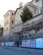
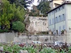
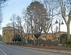
Cross the road to the foyer of the moving walkway on the left (behind the lamp post in this photograph), which opened in 2008. Part of a long stretch of the Roman wall (see below) that was excavated during the building of the walkway is exposed inside, along with a plaster cast of a Roman inscription.
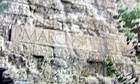
Turn left on leaving the foyer, cross Via Egio and continue along Viale Matteotti to Piazza Carducci. Look back to see a stretch of the walls high up in a private garden in Via Egio, on the right, which is contiguous with the stretch excavated in the foyer.
The plaster cast in the foyer (above) came from an inscription (1st century BC) in this stretch of walls that records the names of the quattuorviri (magistrates) who restored it. The explanatory panel in the foyer includes this photograph of the inscription, in which the name of one of magistrates, P. Marcus P. Hister, is legible.
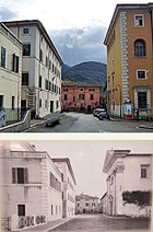
Piazza Carducci is named for the poet Giosuè Carducci, who wrote his “Alle Fonte del Clitunno” in Spoleto in 1876.
-
✴Palazzo Toni (17th century) on the left now houses the Liceo Pontano Sansi (named for Giovanni Pontano di Cerreto and Achille Sansi).
-
✴The Servite church of San Luca opposite was adapted in 1947 as a school for girls. Walk a little further along Viale Matteoti to see the remains of the Servite convent.
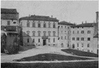
The lower photograph of Piazza Carducci was taken n 1891, before the church of San Luca (on the right) was demolished.
Take a short detour by continuing along Viale Matteotti, to see the remains of the Servite convent.
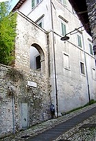
Return to to Piazza Carducci and fork right along Via Egio, past Pizzeria Tre Fontane and into a small piazza. Climb the steps of Via delle Cantoncelle opposite: the palace ahead stands on foundations provided by the Roman walls. (“Cantoncelle” is a dialect word for “small corners”, which is probably a reference to the dogleg at the start of the street). This street continues as Via Lauri and ends as an arched passage under Palazzo Mauri (see Walk I).
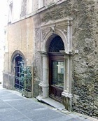
Turn right along Via Brignone through the Arco di Monterone, the only surviving gate from the Roman walls. Continue to the junction with Via delle Felice. There are early Christian reliefs in the arch at the end of the road.
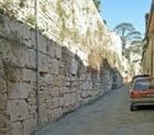
Walk along Via delle Felice, with the remains of the Roman wall on the left.
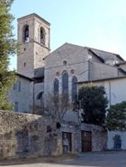
The footpath to the right (just past number 17) leads down around a fenced property to the ruins of the ancient Abbazia di San Marco on the left. It is worth walking along this path for a fine view of the apse of SS Simone e Giuda (see below) and of Colle Attivole (or dei Cappuccini) and Monteluco.
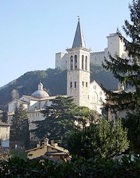
Retrace your steps and turn right to continue along Via della Felice. Turn left up the steps to the right of the abandoned Franciscan church of SS Simone e Giuda and then turn right at the top, to see its sad facade. You are now in Piazza Campello, which is the largest and highest of the open spaces of the city, has long been the site of the residences of the Campello family (see below). The space has been used for various purposes over the centuries: for example, a pig market was held here for a period until 1642; and a wooden amphitheatre for bull fighting was opened here in 1819. The space was also used for church services and other public gatherings after the earthquakes that plagued the city from time to time. It took on its present appearance in 1863, when SS Simone e Giuda was abandoned and the trees that give it its current cool and shady character were planted.
A walkway over Via Brignone, to the left of the palace, leads to its gardens.
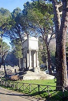
Proceed anti-clockwise from the palace, past SS Simone e Giuda to the Fontana di Mascherone. The war memorial (1910) stands among the trees opposite the fountain. It commemorates the men who died here on 17th September, 1860, when the Piedmontese troops of General Filippo Brignone took the Rocca from the vastly out-numbered papal forces in the war of Italian Reunification.
The path between the fountain and the war memorial leads up to summit of Colle di Sant’ Elia, which is the highest point of the city. It was the site of a walled citadel from at least from the Bronze Age and was probably the acropolis of the Roman city. [Finds in Museo Archeologico ??] Little is known about its later development, except that the church of Sant’ Elia stood on the western slope, above the site of the present Duomo (see below). The Rocca di Albornoz, which was built at the summit in 1359-70, now houses the Museo del Ducato di Spoleto.
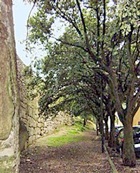
On leaving the Rocca, you can take a circular detour of about 1 km by turning sharp left along around the Giro della Rocca (opened in 1817), which follows the line of the ancient citadel walls. The remains of these walls can be seen on the left.
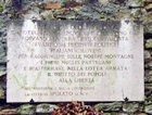
The inscription on the left commemorates the escape in October 1943 of a number of political prisoners held in the Rocca, many of whom subsequently formed the nucleus of the local Anti-Facist resistance movement.
The road swings left, with Monteluco (see Walk IV) across the ravine of the Tessino on your right and the Ponte delle Torri ahead. Continue around the Giro della Rocca, which soon swings sharply to the left and down the slope of the hill. The church of Sant’ Elia stood below the short side of the Rocca here, just inside the ancient wall.
Cross Piazza Campello diagonally to the right and turn right into Via Aurelio Saffi. Turn right again down the steps of Via dell' Arringo into Piazza del Duomo, where the walk ends.